Zion Canyon
Zion Canyon is the most well-known section of Zion National Park. With high red canyon walls all around you , and amazing views in each direction, it is no wonder that Zion Canyon is the area of Zion National Park that receives the most visitors. Zion Canyon Scenic Drive, the road that takes you into Zion Canyon, has a free shuttle that runs through it in the busy season in order to keep automobile traffic light. This free shuttle will take you to all the trailheads in Zion Canyon. Many of the trails within Zion Canyon are short and some of the trails in Zion Canyon are even paved, making some of these trails a good option for families with small children. However, there are also some popular difficult hiking trails as well as a few less traveled trails toward the East side of Zion Canyon for those looking to take a longer, more difficult backpacking trip.
East Rim
Description: East Rim is a Day Hike that take you from the East Entrance Trailhead until it intersects the Observation Point Trail.
Distance: 7.8 Miles
Difficulty: Moderate
Highest Elevation: 6,370 Feet Above Sea Level
Jurisdiction: Zion National Park
Distance: 7.8 Miles
Difficulty: Moderate
Highest Elevation: 6,370 Feet Above Sea Level
Jurisdiction: Zion National Park
East Mesa
Description: Day Hike that offers another route to Observation Point.
Distance: 3 Miles One Way
Difficulty: Easy
Highest Elevation: 6,810 Feet Above Sea Level
Jurisdiction: Zion National Park
Distance: 3 Miles One Way
Difficulty: Easy
Highest Elevation: 6,810 Feet Above Sea Level
Jurisdiction: Zion National Park
Cable and Deertrap Mountains
Description: A Day Hike from Zion National Park’s Eastern border to your choice of either Cable Mountain or the Deertrap Mountains.
Distance: Dependent upon which of the many routes you take.
Difficulty: Moderate- Difficult
Jurisdiction: Zion National Park
Distance: Dependent upon which of the many routes you take.
Difficulty: Moderate- Difficult
Jurisdiction: Zion National Park
Canyon Overlook
Description: A Short Hike to a Lookout Point viewing lower Zion Canyon
Distance: 0.5 Miles One Way
Difficulty: Moderate
Highest Elevation: 5,250 Feet Above Sea Level
Dangers: High Cliffs
Jurisdiction: Zion National Park
Distance: 0.5 Miles One Way
Difficulty: Moderate
Highest Elevation: 5,250 Feet Above Sea Level
Dangers: High Cliffs
Jurisdiction: Zion National Park
The Barracks
Description: Wilderness trail that heads from the East Fork of the Virgin River down through rocky canyons and out through a difficult, brushy, bushwacking hike on a faint trail.
Distance: 18.4 Miles
Difficulty: Difficult if you take Checkerboard Mesa.
Highest Elevation: 6,020 Feet Above Sea Level
Dangers: Flash Flood Possibilities & Rugged, Steep Terrain. The long distance may keep you overnight should anything unexpected occur.
Jurisdiction: BLM (Bureau of Land Management), Kanab Field Office; Zion National Park
The Watchman
Description: A short hike that takes you into the small hills that lie below The Watchman and Bridge Mountain.
Distance: 3 Miles Round Trip
Difficulty: Easy
Highest Elevation: 4,350 Feet Above Sea Level
Jurisdiction: Zion National Park
Distance: 3 Miles Round Trip
Difficulty: Easy
Highest Elevation: 4,350 Feet Above Sea Level
Jurisdiction: Zion National Park
Sand Bench Loop
Description: Sand Bench Loop takes you through the dry, sandy country of lower Zion Canyon. Not recommended as a hiking trail at all- but is better done by horseback.
Distance: 3.4 miles round trip
Difficulty: Moderate
Highest Elevation: 4,710 Feet Above Sea Level
Jurisdiction: Zion National Park
Distance: 3.4 miles round trip
Difficulty: Moderate
Highest Elevation: 4,710 Feet Above Sea Level
Jurisdiction: Zion National Park
The West Bank of the Virgin River
Description: A hike following the Virgin River on easy, level ground. Distance: 2.6 Miles One Way ending at The Grotto Trailhead.
Difficulty: Easy
Highest Elevation: 4,450 Feet Above Sea Level
Jurisdiction: Zion National Park
Difficulty: Easy
Highest Elevation: 4,450 Feet Above Sea Level
Jurisdiction: Zion National Park
Emerald Pools
Description: A spiderweb of trails that all lead, by various lengths and means, to Emerald Pools Lower, Middle and Upper Pools.
Distance: 1.2 Miles to 2.5 Miles Round Trip.
Difficulty: Easy (for the Lower and Middle Pools); Moderate (for the Upper Pool.)
Highest Elevation: 4,450 Feet Above Sea Level
Jurisdiction: Zion National Park
Distance: 1.2 Miles to 2.5 Miles Round Trip.
Difficulty: Easy (for the Lower and Middle Pools); Moderate (for the Upper Pool.)
Highest Elevation: 4,450 Feet Above Sea Level
Jurisdiction: Zion National Park
Angel’s Landing
Description: A steep ascent to the high cliffs of Angel’s Landing, climbing 1,600 feet.
Distance: 2.2 Miles One Way
Difficulty: Strenuous
Highest Elevation: 5,790 Feet Above Sea Level.
Dangers: High Cliffs. Some die almost each year (since 2017) by falling from Angel’s Landing.
Jurisdiction: Zion National Park
Distance: 2.2 Miles One Way
Difficulty: Strenuous
Highest Elevation: 5,790 Feet Above Sea Level.
Dangers: High Cliffs. Some die almost each year (since 2017) by falling from Angel’s Landing.
Jurisdiction: Zion National Park
Observation Point
Description: A long hike that takes you from the Zion Canyon floor to the high overlook of Observation Point, climbing 2,200 feet.
Distance: 4 Miles One Way
Difficulty: Somewhat Strenuous
Highest Elevation: 6.507 Feet Above Sea Level
Dangers: High Cliffs
Jurisdiction: Zion National Park
Distance: 4 Miles One Way
Difficulty: Somewhat Strenuous
Highest Elevation: 6.507 Feet Above Sea Level
Dangers: High Cliffs
Jurisdiction: Zion National Park
Hidden Canyon
Description: A turnoff from the Observation Point trail that takes you into Hidden Canyon, a narrow canyon that eventually dead ends at a high wall that should only be attempted by experienced rock climbers with proper rock climbing equipment.
Distance: 3 Miles
Difficulty: Moderate
Jurisdiction: Zion National Park
Hidden Canyon is closed indefinitely due to rockslides.
Distance: 3 Miles
Difficulty: Moderate
Jurisdiction: Zion National Park
Hidden Canyon is closed indefinitely due to rockslides.
Riverside Walk
Description: An easy, paved walk that takes you from the Temple of Sinawava along the Virgin River, ending where The Narrows truly begins. The first half of this trail is wheelchair accessible. After that, there are enough steep grades that wheelchairs are not recommended.
Distance: 1.8 Miles Round Trip
Difficulty: Easy
Jurisdiction: Zion National Park
Distance: 1.8 Miles Round Trip
Difficulty: Easy
Jurisdiction: Zion National Park
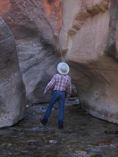
The Narrows: Orderville Canyon
Description: A One-Way Day Trip that takes you through the lower portion of The Narrows
Distance: 3 Miles One Way
Highest Elevation: 4,700 Feet Above Sea Level
Dangers: Possibility of Flash Floods if precautions are not taken to make sure there are no rain storms occurring either above or within Zion National Park.
Jurisdiction: Zion National Park
Distance: 3 Miles One Way
Highest Elevation: 4,700 Feet Above Sea Level
Dangers: Possibility of Flash Floods if precautions are not taken to make sure there are no rain storms occurring either above or within Zion National Park.
Jurisdiction: Zion National Park
The Narrows: Top-Down Route
Description: A long day-hike or a backpack trip down the North Fork of the Virgin River through one of Zion’s most iconic areas, The Narrows.
Distance: 15.4 Miles
Difficulty: Somewhat Strenuous
Highest Elevation: 5,640 Feet Above Sea Level. This hike takes you down 1,200 feet.
Dangers: Possible Flash Floods; Cold Water in Spring and Fall
Permit: Required
Equipment: A Wading Staff is Extremely Important
Jurisdiction: Zion National Park
Distance: 15.4 Miles
Difficulty: Somewhat Strenuous
Highest Elevation: 5,640 Feet Above Sea Level. This hike takes you down 1,200 feet.
Dangers: Possible Flash Floods; Cold Water in Spring and Fall
Permit: Required
Equipment: A Wading Staff is Extremely Important
Jurisdiction: Zion National Park
The Narrows: From the Bottom Up
Description: A hike upstream in the Virgin River that takes you into The Narrows in Zion Canyon]
Difficulty: Moderate
Distance: 5 Miles round trip
Recommended Equipment: Wet pants when water is cold. Wading Staff all the time.
Jurisdiction: Zion National Park
Difficulty: Moderate
Distance: 5 Miles round trip
Recommended Equipment: Wet pants when water is cold. Wading Staff all the time.
Jurisdiction: Zion National Park
Deep Creek
Description: A backpacking trip that will take at least two days. The trail follows a wilderness route down Deep Creek until it reaches the Virgin River and The Narrows. The hike drops almost 3,000 feet in elevation.
Distance: 14.2 Miles One Way
Difficulty: Moderately Strenuous
Dangers: Possible Flash Flooding and Possible Cold Waters
Highest Elevation: 7,900 Feet Above Sea Level
Jurisdiction: BLM (Bureau of Land Management), Kanab Field Office; Zion National Park
Distance: 14.2 Miles One Way
Difficulty: Moderately Strenuous
Dangers: Possible Flash Flooding and Possible Cold Waters
Highest Elevation: 7,900 Feet Above Sea Level
Jurisdiction: BLM (Bureau of Land Management), Kanab Field Office; Zion National Park