Cedar Breaks and the Markagunt Plateau
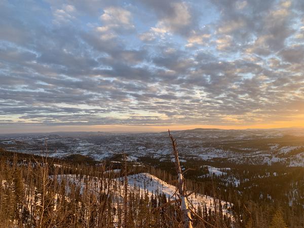
The Markagunt Plateau makes up some of the highest country in southern Utah. The very name “Markagunt” is a Paiute word meaning “High Land of Trees.” As this name would imply, the Markagunt Plateau is a high elevation area, with Brian Head Peak reaching up to 11,306 feet above sea level. Lower reaches of the Markagunt are a juniper-pinyon woodland. As you climb to about 7,500 Feet Above Sea level, the forest type changes to more of an alpine forest with larger fir, spruce and quaking aspen. Bristlecone pine are found at Cedar Breaks, which are an extremely old and slow growing pine, able to withstand long droughts as well as extremely cold weather.
Some areas, such as Cedar Breaks National Monument, have weathered to become very similar in appearance to Bryce Canyon National Park, with red hoodoos and steep drop offs. The entire Markagunt Plateau is riddled with ancient volcanic activity. Near Duck Creek, you can see several miles of lava rock extending across the plateau.
There are several hiking trails and horseback riding trails all over the Markagunt. However, the large amounts of snow make the area most suitable for such activities in the summer and fall. The spring is plenty warm for such outdoor activities; but it is quite usual for snow drifts to remain and block trails and some roads well into June.
The primary access to the Markagunt Plateau is Utah Highway 14, which begins in Cedar City Utah and takes you to Long Valley Junction at Utah Highway 89, from which junction you may descend southward for Kanab and the Zion National Park or Grand Canyon National Park areas or you may head northward for Bryce Canyon National Park. It is Highway 14 that makes for a beautiful drive from Rising K Ranch to Bryce Canyon National Park. Many of our horseback riding guests at Rising K Ranch come from Zion National Park and ride with us before driving north on Utah Highway 14 to Bryce Canyon National Park.
Rather than being managed by the National Park Service, the Markagunt Plateau is largely made up of Dixie National Forest. This makes the area less restricted as far as access to hunting, horseback riding, camping, fishing, and just bringing your dogs and guns in general to go be free in the beauty of America!
Ramparts Trail and Spectra Point
Description: A short trail that follows the rim of Cedar Breaks National Monument
Distance: 1.5 Miles One Way
Difficulty: Moderate
Highest Elevation: 10,492 Feet Above Sea Level
Dangers: High Cliffs; Lightning Strikes
Jurisdiction: Cedar Breaks National Monument
Distance: 1.5 Miles One Way
Difficulty: Moderate
Highest Elevation: 10,492 Feet Above Sea Level
Dangers: High Cliffs; Lightning Strikes
Jurisdiction: Cedar Breaks National Monument
Alpine Pond
Description: A short hiking trail that takes you on a 2.2 mile loop through the alpine forests in the high country of the Markagunt Plateau.
Distance: 1.1 Mile One Way
Difficulty: Moderate
Highest Elevation: 10,660 Feet Above Sea Level
Jurisdiction: Cedar Breaks National Monument
Distance: 1.1 Mile One Way
Difficulty: Moderate
Highest Elevation: 10,660 Feet Above Sea Level
Jurisdiction: Cedar Breaks National Monument
Rattlesnake Creek & Ashdown Gorge
Description: A trail that takes you from the high elevation of the Markagunt Plateau down to the lower elevations of the mouth of Ashdown Gorge.
Distance: 9.5 Miles
Difficulty: Moderate is traveling from east to west (downhill); Difficult if traveling from west to east (uphill.)
Highest Elevation: 10,456 Feet Above Sea Level
Dangers: Potential Flash Flooding in Ashdown Gorge- do not go if there is possibility of storms.
Recommended Equipment: Wading Staff for hiking in the water.
Jurisdiction: Dixie National Forest
Cedar Breaks Bottoms
Description: Cedar Breaks Bottoms is a backpacking trail that takes you from Dixie National Forest’s “Crystal Spring” to Cedar Breaks National Monument.
Distance: 8.9 to 11.3 Miles One Way (Depending upon which routes you take.)
Difficulty: Somewhat Strenuous
Highest Elevation: 9,000 Feet Above Sea Level
Jurisdiction: Dixie National Forest; Cedar Breaks National Monument
Distance: 8.9 to 11.3 Miles One Way (Depending upon which routes you take.)
Difficulty: Somewhat Strenuous
Highest Elevation: 9,000 Feet Above Sea Level
Jurisdiction: Dixie National Forest; Cedar Breaks National Monument